![]()
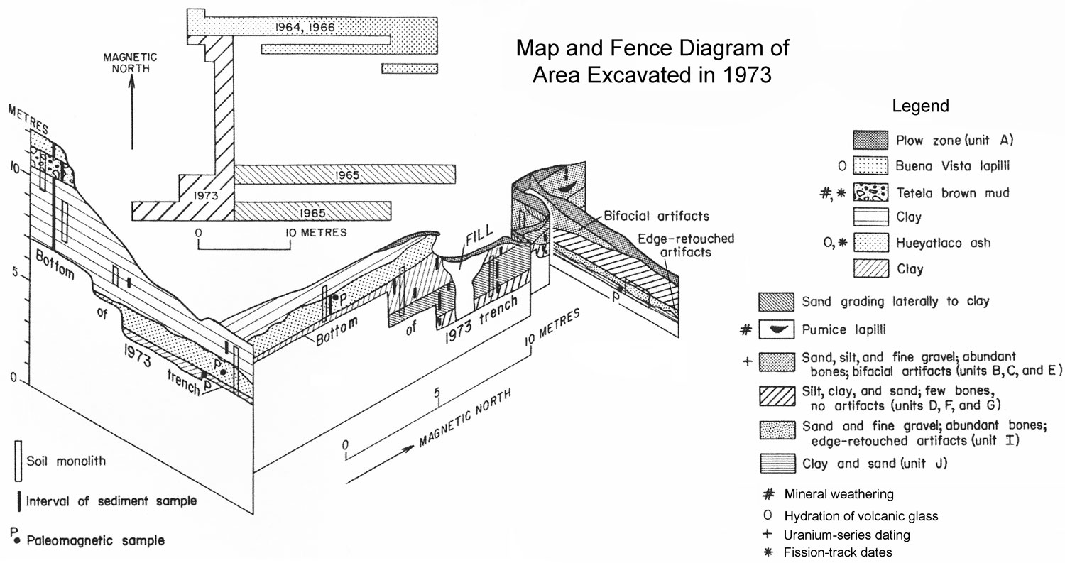
FIGURE 13. Map of area excavated in 1973 and fence diagram based on mapping done in profile at a scale of 1 to 20. The east-west section along the 1964-1966 trench is generalized from unpublished open file reports by Irwin-Williams to the INAH. Stratigraphic units identified by letter refer to units designated by her. Marginal symbols indicate various methods of dating: # mineral weathering; 0 hydration of volcanic glass; + uranium-series dates; and * fission-track ages. The positions of samples taken for sedimentary analysis and for paleomagnetic measurement are marked. Only one set of soil monoliths is shown, but a duplicate set was taken for the INAH. (Reproduced from Steen-McIntyre et al., 1981.)